Here is the list of some valuable historical maps
found at various sources. Author is currently working on more detailed
maps related to each reign. Due to copyright questions, author did
not
risk to post those maps at this time. If you would like to
participate
on map project for Germany or any other country please contact the
author at germany@igorclub.zzn.com.
Tacitus' Germania -this map shows territory settled by various Germanic tribes during the time of the famous Roman historian, Tacitus. See for yourself to what extent should you trust this map.
Carolingian Germany - source: "Encyclopedia of Britannica", this good quality, fast loadable map shows major German states that composed kingdom of East Franks (later kingdom of Germany) during its first two dynasties, Carolingians and Ludolfings from approximately 877 to about the year 964. During the age of Holy Roman Empire, provinces shown were included in administrative unit Kingdom of Germany as part of the Empire.
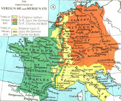
Germany 844-870 -another Carolingian Germany map. Shows territories of given to each of the Carolingian brothers according the treaties of Verdun (843) and of Mersen (870). It is not detailed and shows Slavic tribes and Bohemia as part of East Frankish Kingdom while there were only tributary states.
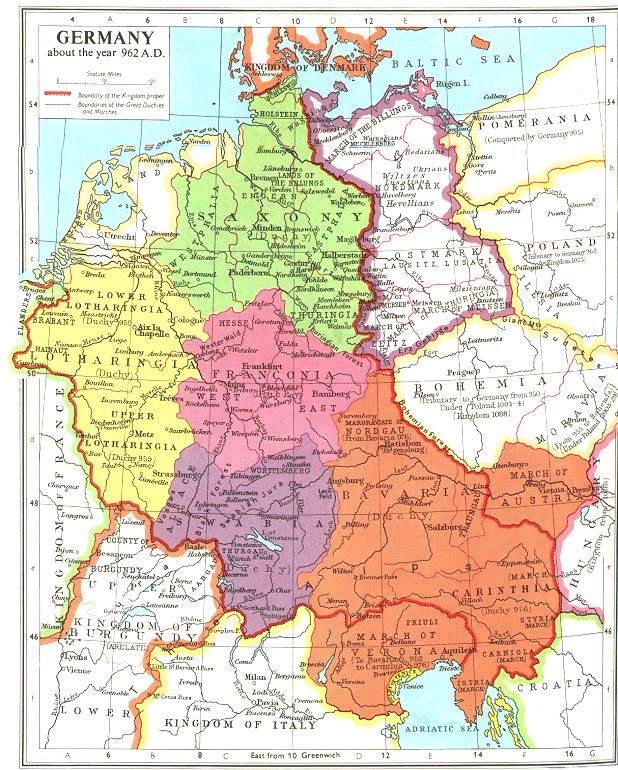
Germany in 962 - this map shows territory of the German kingdom in the year 962 when the Holy Roman Empire was created by Otto the Great. In addition to the ancient duchies it shows administrative divisions in newly-conquered Slavic Marches
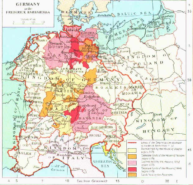
Barbarossa's Germany - on the next map you will find graphically represented information about two rival parties: Staufens and Welfs. Emphasized personal possessions of each family as well as duchies governed by each clan representatives.
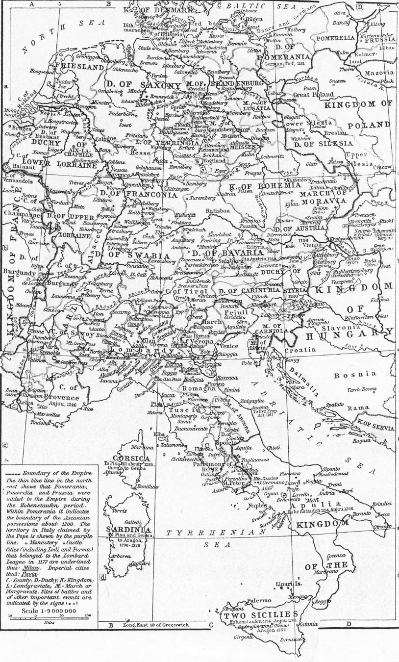
Hohenstaufen Germany - this shows the Empire at its highest territorial expansion 1190s-1268 during the last rulers of Hohenstaufen family when kingdom of Sicily was allied with Empire in dynastic union.
Empire in 1200 - this map shows territorial domain of the major imperial families. It is in German but due to a small font it is hard to read and is not zoom-able.
Empire in 1600 - at the close of Middle Ages, Empire was composed of many feudal princedoms which replaced the ancient duchies. The major provinces partially similar to those of the modern countries and states are: Lower Rhine-Westphalia, Lower Saxony, Brandenburg, (Upper-) Saxony, Hesse, Pfaltz, Baden, Wurtemberg, Bavaria etc. Archduchy of Austria and Kingdom of Bohemia (including Silesia) belonging to Habsburgs shown as separate administrative units.
Germany in1917 - here you will see German Empire towards the end of the World War I. Map also shows territories of the major Imperial princedoms.
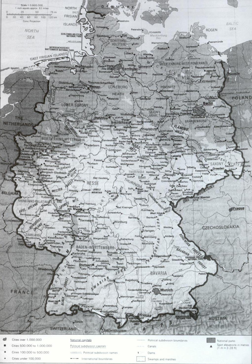
Modern Germany - this map shows Germany since the time of unification in 1990.
Following list of maps with relatively small sizes is not of that good quality. However it has some details due to which author feels obliged to post them in here. Author apologizes for he does not remember what size did he found those maps from and is ready to post link to this site upon request.
Central Europe in 980 -shows administrative divisions within Germany and France
Central Europe in 1180 -shows administrative sub-kingdoms of the Holy Roman Empire: kingdom of Germany, of Burgundy and of Italy. Also shows extent of Angevin power in France.
Central Europe in 1360 - shows territorial domains of the Imperial major princely families: Luxemburg, Habsburg, Brandenburg, Savoy, beginning of Swiss confederation and some details on France.
Central Europe in 1460 - shows among the other details, territories ruled by Luxemburg, and Habsburg, as well as Burgundian possessions in both Empire and France.
Central Europe in 1555 - shows domains of Austrian and Spanish Habsburgs within the Empire as well as outside of it.
Central Europe in 1660 -shows expansion of Austrian Habsburg and Brandenburg lands and decrease of Spanish Habsburg territories within the Empire.
Central Europe in 1780 - shows further growth of Austrian Habsburg and Hohenzollern Prussian-Brandenburg lands within and outside of Empire.
Central Europe in 1801 - shows Holy Roman Empire just before its fall in 1806 with Habsburg and Hohenzollern families as its major political powers.
Central Europe in 1810 - shows French Imperial lands, counties of the Rheine Confederation, Kingdom of Prussia and Austrian Empire.
Central Europe in 1815 - shows the territory of the German confederation with Prussian and Austrian lands as its major powers.
Central Europe in 1860 - shows Germany before unification. Habsburg vs. Hohenzollern.
Central Europe in 1871 - shows the territory of the German Empire unified by the Prussian Hohenzollerns and the Austrian Empire as the separate political entity.
Alternative Historical Resources related to Germany:
Austria
Belgium
Bohemia
Liechtenstein
Luxemburg
Netherlands
Switzerland
Royal Genealogy Biographies of the German rulers